
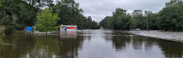
More than 45 U.S. Geological Survey scientists are in the field today from Louisiana to Georgia, working to measure the extensive flooding across the Southeast caused by Hurricane Sally’s heavy rains.
More than 45 U.S. Geological Survey scientists are in the field today from Louisiana to Georgia, working to measure the extensive flooding across the Southeast caused by Hurricane Sally’s heavy rains. Some early estimates indicate Sally dumped as much as 20 inches of rain in areas between Mobile Bay in Alabama and Pensacola, Florida.
USGS field crews are also repairing several USGS streamgages damaged by Sally, which is vital to ensuring the data USGS streamgages provide on river levels and flow continues to reach emergency managers, flood forecasters and anyone threatened by potentially catastrophic flooding caused by Hurricane Sally.
During and after a storm, USGS streamgage information can be used by the National Weather Service to track floodwaters in real-time as they develop flood forecasts that are used to protect lives and property. The U.S. Army Corps of Engineers also use USGS data to manage flood control at dams and reservoirs across affected regions.
Once a storm has passed, emergency managers can use USGS data to decide where to locate relief centers, so that aid can reach the most severely affected communities quickly.
Continue reading at USGS.
Image via USGS.


