
NASA’s Terra satellite obtained visible imagery of recently formed Tropical Depression 14W as it strengthened into a tropical storm.
NASA’s Terra satellite obtained visible imagery of recently formed Tropical Depression 14W as it strengthened into a tropical storm. Terra satellite imagery showed the storm was organizing.
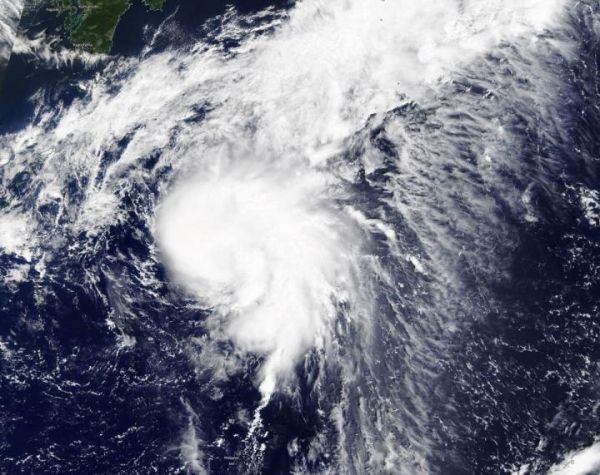
Dolphin developed from Tropical Depression 14W. 14W formed on Sept. 20 about 366 miles east-southeast of Kadena Air Base, Okinawa Island, Japan. By 5 a.m. EDT (0900 UTC) on Sept. 21, the storm organized and strengthened into a tropical storm.
NASA Satellite View: Dolphin’s Organization
The Moderate Resolution Imaging Spectroradiometer or MODIS instrument that flies aboard NASA’s Terra satellite captured a visible image of Tropical Storm Dolphin on Sept. 21. Satellite imagery revealed a persistent deep convection and development of thunderstorms wrapping into a low-level circulation center. That is an indication of consolidation and better organization.
Read more at NASA/Goddard Space Flight Center
Image: NASA's Terra satellite provided a visible image to forecasters of Tropical Storm Dolphin on Sept. 21. The imagery showed the storm was consolidating and organizing. (Credit: Image Courtesy: NASA Worldview, Earth Observing System Data and Information System (EOSDIS)).


