
NASA’s Terra satellite obtained visible imagery of Tropical Storm Dolphin as it continued moving north though the Northwestern Pacific Ocean on a track toward east central Japan.
NASA’s Terra satellite obtained visible imagery of Tropical Storm Dolphin as it continued moving north though the Northwestern Pacific Ocean on a track toward east central Japan.
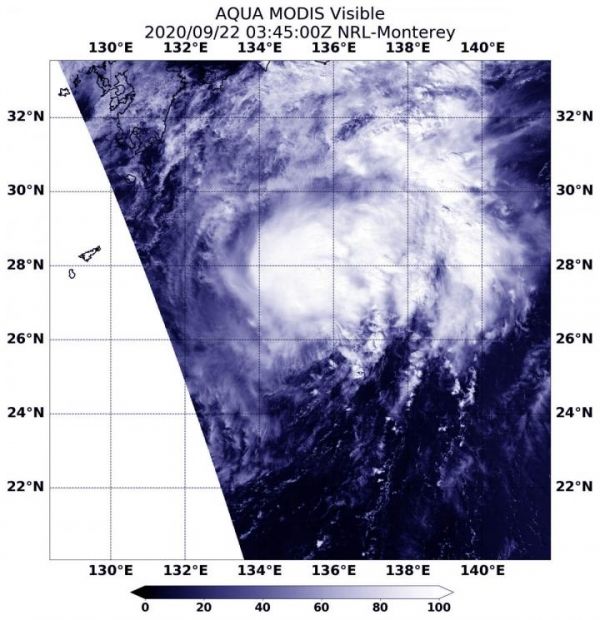
NASA Satellite View: Dolphin’s Organization
The Moderate Resolution Imaging Spectroradiometer or MODIS instrument that flies aboard NASA’s Terra satellite captured a visible image of Tropical Storm Dolphin on Sept. 22 at 0345 UTC (Sept. 21 at 11:45 p.m. EDT). The visible image revealed strong storms around the low-level center of circulation with bands of thunderstorms in the northeastern quadrant. Microwave satellite imagery revealed an eye feature.
The Joint Typhoon Warning Center noted that another satellite image indicates that the upper-level circulation center is tilted about 30 nautical miles east of the low-level center due to increasing westerly vertical wind shear.
NASA’s Terra satellite is one in a fleet of NASA satellites that provide data for hurricane research.
Read more at NASA/Goddard Space Flight Center
Image: On Sept. 22, 2020, NASA's Terra satellite provided a visible image of Tropical Storm Dolphin as it continued moving north through the Northwestern Pacific Ocean. (Credit: NASA/NRL)


