
Wildfires have been burning across the state of California for weeks – some of them becoming larger complexes as different fires merge.
One of those was the August Complex Fire, which reportedly began as 37 distinct fires caused by lightning strikes in northern California on Aug. 17. That fire is still burning over a month later.
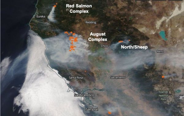
The August Complex Fire and others this fire season have been sending far-reaching plumes of wildfire smoke into the atmosphere that worsen air quality in California and beyond. Predicting where that smoke will travel and how bad the air will be downwind is a challenge, but Earth-observing satellites can help. Included among them are NASA’s Terra and CALIPSO satellites, and the joint NASA-National Oceanic and Atmospheric Association (NOAA) Suomi NPP satellite. Together, the instruments on these satellites provide glimpses at the smoke over time, which can help improve air quality predictions.
“The satellite instruments have the advantage of providing broad coverage and consistent measurement accuracy over time, as well as making their observations without any risk to the people taking the data,” said Ralph Kahn, a senior research scientist with the Earth Sciences Division at NASA’s Goddard Space Flight Center in Greenbelt, Maryland, who studies aerosols. Kahn and other atmospheric scientists at NASA collect data about the fires from Earth-observing satellites used to improve models that predict how wildfire smoke will affect air quality downwind of the fires.
Continue reading at NASA Goddard Space Flight Center
Image via NASA Goddard Space Flight Center


