
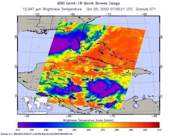
NASA’s Aqua satellite analyzed Tropical Storm Delta in infrared imagery as it moved through the Caribbean Sea.
The imagery provided cloud top temperatures to identify the strongest areas within the storm.
Potential Tropical Cyclone 26 formed in the Caribbean Sea on Sunday, Oct. 4 by 5 p.m. EDT. Six hours later, the National Hurricane Center (NHC) classified it as Tropical Depression 26. By 8 a.m. EDT, satellite imagery helped confirm that the depression had strengthened into a tropical storm. At that time, it was given the name Delta.
One of the ways NASA researches tropical cyclones is using infrared data that provides temperature information. The AIRS instrument aboard NASA’s Aqua satellite captured a look at those temperatures in Delta and gave insight into the size of the storm and its rainfall potential.
Continue reading at NASA Goddard Space Flight Center
Image via NASA Goddard Space Flight Center


