
The blaze grew 140,000 acres in 24 hours to become the second largest fire in Colorado history.
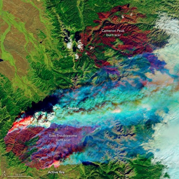
On October 14, 2020, a small fire started north of Hot Sulphur Springs in north-central Colorado. Within ten days, the East Troublesome fire had burned through more than 190,000 acres (77,000 hectares) and had become Colorado’s second largest fire (by area) on record. As of October 26, 2020, it was 15 percent contained.
East Troublesome experienced extensive growth on October 21, growing from 30,000 acres to 170,000 acres in about 24 hours. The rapid growth was fueled by strong winds that blew flames east into the Rocky Mountains. The fire burned quickly through lodgepole pine forests, which had already been weakened by drought and an infestation of bark beetles. The blaze has killed at least two people, destroyed hundreds of homes, and prompted evacuations in several nearby areas, including the entire town of Grand Lake.
On October 22, 2020, the Operational Land Imager (OLI) on Landsat 8 captured these natural-color (left) and false-color (right) images of the East Troublesome fire. The false-color image combines shortwave infrared, near-infrared, and green light (bands 7-5-2) to show active fires (bright red), scarred land consumed by fire (darker red), and intact vegetation (green).
Continue reading at NASA Earth Observatory
Image via NASA Earth Observatory


