
Specially-adapted drones, developed by an international team involving scientists from the University of Cambridge, are transforming how we forecast eruptions by allowing close-range measurements of previously inaccessible and hazardous volcanoes.
Specially-adapted drones, developed by an international team involving scientists from the University of Cambridge, are transforming how we forecast eruptions by allowing close-range measurements of previously inaccessible and hazardous volcanoes.
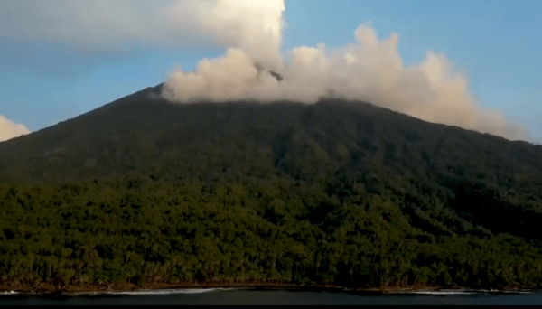
The team, involving 20 researchers from seven countries, used long-range drones kitted out with a range of lightweight sensors to study the Manam volcano - one of the most active volcanoes in Papua New Guinea.
Their findings, published in the journal Science Advances, show how combined measurements from the air, earth and space can be used to understand volcanic contributions to the global carbon cycle, key to sustaining life on Earth.
One of the best ways to detect signs of an impending eruption is to ‘breathalyze’ a volcano by taking regular measurements of volcanic gases. Any change in the ratio of sulfur and carbon dioxide released can warn of an impending eruption. But sampling more remote or hazardous volcanoes like Manam is more challenging.
Continue reading at University of Cambridge.
Image via University of Cambridge.


