
A remote monitoring tool to help authorities manage public safety and environmental issues in recently abandoned coal mines has been developed by the University of Nottingham.
A remote monitoring tool to help authorities manage public safety and environmental issues in recently abandoned coal mines has been developed by the University of Nottingham.
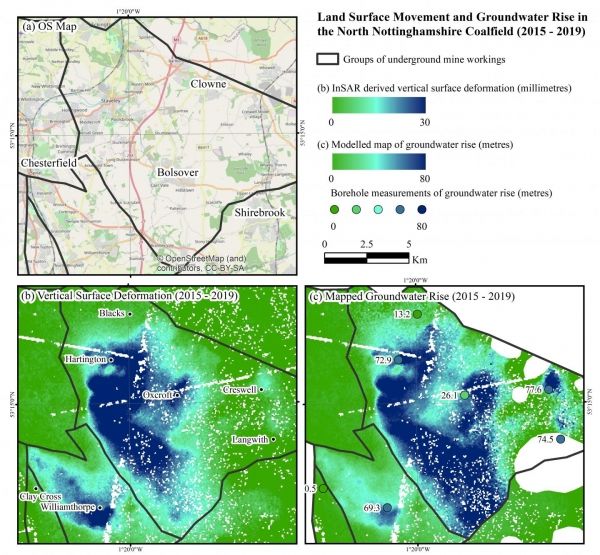
The tool uses satellite radar imagery to capture millimetre-scale measurements of changes in terrain height. Such measurements can be used to monitor and forecast groundwater levels and changes in geological conditions deep below the earth’s surface in former mining areas.
With a long history of coal mining, the project was tested in the UK at a regional scale, but has global implications given the worldwide decline in the demand for coal in favour of more sustainable energy sources.
The method was implemented over the Nottinghamshire coalfields, which were abandoned as recently as 2015, when the last deep mine, Thoresby Colliery, shut its doors for good.
Read more: University of Nottingham
Figure 1 shows land surface uplift measured using satellite data which has been utilised to calculate changes in groundwater levels. (Photo Credit: University of Nottingham)


