
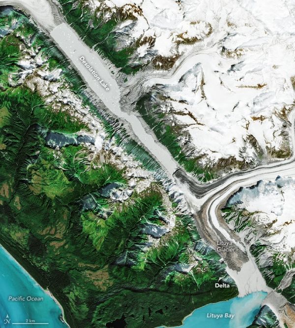
A flood in a glacial lake behind Lituya Glacier surprised an unsuspecting fisherman and reworked a young delta in Alaska.
Lituya Bay is best known among geologists for a landslide in 1958 that slammed into its waters and triggered one of the largest tsunami waves known to science. But that is not the only dramatic geologic phenomenon lurking in this glacier-sculpted fjord in southeastern Alaska.
In August 2020, a commercial fisherman noticed a surprisingly strong current of muddy water, trees, and chunks of ice rushing against the tide near the head of the bay. He alerted a geologist at the National Park Service, and a small team of researchers has since pieced together what likely caused the surge of floodwater. Their investigative tool of choice? Satellites.
“We can see clearly using Sentinel 2, Landsat 8, and Planet Labs imagery that a huge lake that had been dammed by Lituya Glacier drained abruptly in mid-August,” explained Bretwood “Hig” Higman, a geologist with Ground Truth Alaska. Events like these are known as glacial lake outburst floods (GLOFs), or sometimes jökulhlaups.
Continue reading at NASA Earth Observatory
Image via NASA Earth Observatory


