
Early ice retreat amid warm Arctic air temperatures set the stage for the slow refreeze in 2020.
After the spring and summer melt season, the cap of frozen seawater floating on top of the Arctic Ocean begins to refreeze. In 2020, however, the annual freeze has been unusually slow.
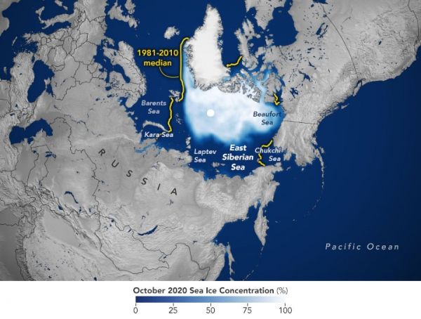
When Arctic sea ice reached its annual minimum in September 2020, it was one of the lowest extents of the satellite record—second only to the record low in September 2012. But unlike 2012, the ocean did not see its typical rate of refreezing in 2020. As a result, the sea ice extent for this October was the lowest on record for any October. Ice growth picked up the pace at the start of November but then slowed again, leaving plenty of open water in the Barents and Kara seas at the start of December.
According to the National Snow & Ice Data Center (NSIDC), October 2020 was “the largest departure from average conditions seen in any month thus far in the satellite record.” Scientists have used satellites to continuously measure sea ice since 1979. The chart above shows how the extent of sea ice has progressed in 2020. For context, ice extents for 2012 (the record low extent) and 2016 (another year with a slow refreeze) are also charted.
Continue reading at NASA Earth Observatory
Image via NASA Earth Observatory


