
Sentinel-6 Michael Freilich will continue a decades-long effort to measure global ocean height from space, which started in the early 1990s.
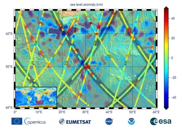
Sentinel-6 Michael Freilich, a joint U.S.-European satellite built to measure global sea surface height, has sent back its first measurements of sea level. The data provide information on sea surface height, wave height, and wind speed off the southern tip of Africa.
"We're excited for Sentinel-6 Michael Freilich to begin its critical work studying sea level and helping us understand the many aspects of our planet's global ocean," said Thomas Zurbuchen, NASA's associate administrator for science at the agency's headquarters in Washington. "I know Mike would be thrilled that the satellite bearing his name has begun operating, but he'd also be looking forward to studying the data from this important mission, as we all are."
Since the successful Nov. 21 launch from Vandenberg Air Force Base in California aboard a Space-X Falcon 9 rocket, engineers and scientists have spent several weeks switching on and checking out the satellite and its instruments, making sure everything is operating as it should.
Continue reading at NASA
Image via NASA


