
The 2020 Atlantic hurricane season was supercharged, and not just in raw numbers.
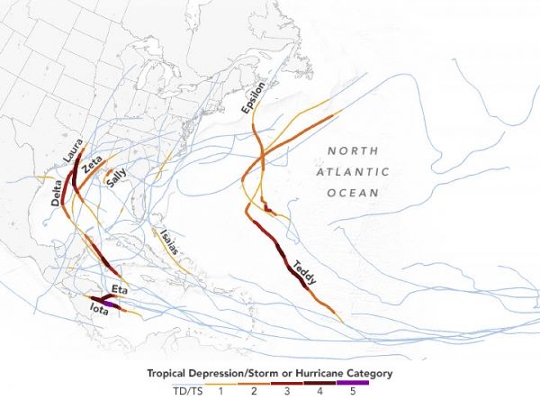
The 2020 Atlantic hurricane season will go down in history as a season of superlatives: the most named storms observed in a year (30); the most storms to make landfall in the continental United States (12); the most to hit Louisiana (5); and the most storms to form in September (10). The 2020 season was supercharged, and not just in the raw numbers.
“What really blew me away were the explosive intensification events,” said Jim Kossin, an atmospheric scientist with the National Oceanic and Atmospheric Administration (NOAA). “For instance, Hurricane Eta’s wind speeds increased around 80 miles (130 kilometers) per hour in one day. There’s rapid intensification, and then there’s really rapid intensification, which is what we saw often this year.”
For the past few decades, hurricanes have been rapidly intensifying more often, and their forward motion has been stalling more. 2020 continued both trends. A record-tying nine storms rapidly intensified, defined as wind speeds increasing at least 35 miles (56 kilometers) per hour within 24 hours. Two named storms stalled; one (Sally) moved at just 2 miles per hour for a period—slower than a walking pace.
Continue reading at NASA Earth Observatory
Image via NASA Earth Observatory


