
Clear skies over the Rocky Mountains helped a temperature inversion to form, which in turn led to cloud-filled valleys.
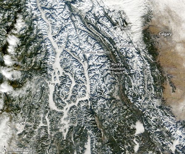
In late autumn 2020, a wide area of the northwestern United States and western Canada bathed in sunlight during a long spell of clear skies. The cloud-free conditions gave satellites an unimpeded view of the landscape, including this image of the snowcapped Rocky Mountains.
The Rockies stretch about 3,000 miles (4800 kilometers) across the western half of North America. This view shows a segment measuring about 400 miles (600 kilometers) long and spanning parts of two Canadian provinces (British Columbia and Alberta) and three U.S. states (Washington, Idaho, and Montana). The image above was acquired on December 3, 2020, with the Moderate Resolution Imaging Spectroradiometer (MODIS) on NASA’s Terra satellite.
The clear skies were the result of a high-pressure weather system that parked over the region during the first week of December. In areas of high pressure, air slowly sinks to lower altitudes and warms, a pattern that inhibits cloud formation.
Continue reading at NASA Earth Observatory
Image via NASA Earth Observatory


