
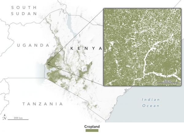
Cropland masks and other environmental data can help agriculture agencies pinpoint where support is most needed.
Nearly 75 percent of Kenya’s people rely on farming for their food and income, so environmental issues like drought, locusts, and climate change can put many lives and livelihoods at risk. Crop insurance programs can help mitigate those risks, but it is not always easy to know where resources are needed. Now NASA-funded scientists are working with colleagues in Kenya to make better assessments of agricultural needs through the use of satellite data.
In the first few years of the country’s crop insurance program, Kenyan agriculture agents collected much of their information through in-person visits, traveling to individual farms to determine how crops were performing and if financial assistance was necessary. It was labor-intensive and time-consuming. Officials urgently needed timely information spanning vast areas of the country—and that is where NASA Earth observations came in.
Continue reading at NASA Earth Observatory
Image via NASA Earth Observatory


