
Scientists have developed a new technique for remotely surveying elephants and other wildlife that is quicker and has the same accuracy as human counts done on the ground or in low-flying airplanes.
Scientists have developed a new technique for remotely surveying elephants and other wildlife that is quicker and has the same accuracy as human counts done on the ground or in low-flying airplanes. The system, which uses satellite images and deep learning, could help improve the monitoring of endangered species in habitats across the globe.
The research, led by scientists at the University of Bath and the University of Oxford in the United Kingdom, created a computer algorithm to analyze high-resolution satellite images and detect African elephants in both grasslands and forests.
African elephant populations have rapidly declined in the past century, with just 40,000 to 50,000 left in the wild. But on-the-ground or airplane surveys to monitor elephant numbers are expensive and time-consuming. Because satellites can collect over 1,900 square miles of imagery every few minutes, they eliminate the risk of double counting and speed up the process from weeks to a just a few days. Using satellites also cuts down on the logistics of monitoring species populations that cross international borders.
Read more at Yale Environment 360
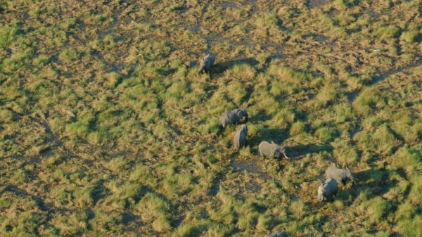
Image: Elephants spotted during a scenic flight over the Okavango Delta in Botswana. DIEGO CUE/WIKIMEDIA COMMONS


