
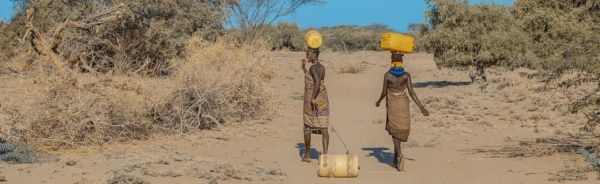
When drought hits the Horn of Africa, it's a threat to lives and livelihoods
Communities need access to water for sanitation, hydration, livestock and agriculture – and in many cases, tapping groundwater supplies is the difference between a "drought" and a "drought emergency." But maintaining the thousands of groundwater pumps that supply fresh water to drought-prone areas in east Africa is a significant challenge. NASA satellite data helps the people who maintain this crucial infrastructure by highlighting the places most at-risk for drought and informing early warning actions to prevent the worst drought impacts on local communities.
"By forecasting water demand, we can support water system operations to ensure that water access is secure during drought periods and costly emergencies are prevented," said Evan Thomas, former NASA engineer and associate professor and director of the Mortenson Center in Global Engineering at the University of Colorado, Boulder.
Thomas leads the Drought Resilience Impact Platform (DRIP), which monitors the water supplies of 3 million people via sensors installed on groundwater pumps across hundreds of sites in Kenya and Ethiopia. The sensors alert the DRIP network if a pump is failing or needs routine maintenance. DRIP was funded by several USAID programs, and partners include the Millennium Water Alliance (MWA), an international water security nonprofit organization.
Continue reading at NASA Earth Sciences Division
Image via NASA Earth Sciences Division


