
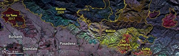
Scientists are using radar data to decipher where and how well landscapes recover in the years after major fires.
For the past few decades, scientists have been using satellite- and airplane-based radar instruments to detect damage caused by wildfires and human-caused blazes. Radar instruments can observe by day or night and can see land through clouds and smoke, so they are helpful for observing fire fronts and burn scars during and shortly after fire ravages a landscape.
Landscape ecologist Naiara Pinto and colleagues at NASA’s Jet Propulsion Laboratory are now taking a longer view. They are trying to decipher where and how well forests and scrublands are recovering in the years after a fire.
Synthetic aperture radar (SAR) instruments send out pulses of microwaves that bounce off of Earth’s surfaces. The reflected waves are detected and recorded by the instrument and can help map the shape of the land surface (topography) and the land cover—from cities to ice to forests.
Continue reading at NASA Earth Observatory
Image via NASA Earth Observatory


