
When the Arctic polar vortex is especially strong and stable, the coldest polar air stays in the Arctic.
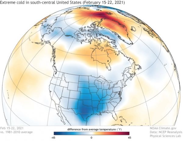
In late February, as the Southern Plains and Gulf Coast suffered through an unusually strong blast of wintry weather, weather talk turned to the polar vortex and the possibility that the extreme cold was yet another example of weather-gone-wild due to global warming. In this article, we’re talking to two NOAA experts about the devastating extreme cold event, the polar vortex, and the potential link to global warming.
The Arctic polar vortex is a band of strong westerly winds that forms in the stratosphere between about 10 and 30 miles above the North Pole every winter. The winds enclose a large pool of extremely cold air. (There is an even stronger polar vortex in the Southern Hemisphere stratosphere in its winter.) The stronger the winds, the more the air inside is isolated from warmer latitudes, and the colder it gets.
Continue reading at NOAA Climate
Image via NOAA Climate


