
Using NASA satellite images and machine learning, researchers with The University of Texas at Austin have mapped changes in the landscape of northwestern Belize over a span of four decades, finding significant losses of forest and wetlands, but also successful regrowth of forest in established conservation zones that protect surviving structures of the ancient Maya.
Using NASA satellite images and machine learning, researchers with The University of Texas at Austin have mapped changes in the landscape of northwestern Belize over a span of four decades, finding significant losses of forest and wetlands, but also successful regrowth of forest in established conservation zones that protect surviving structures of the ancient Maya.
The research serves as a case study for other rapidly developing and tropical regions of the globe, especially in places struggling to balance forest and wetland conservation with agricultural needs and food security.
“Broad-scale global studies show that tropical deforestation and wetland destruction is occurring rapidly, which contributes to climate change in multiple ways such as through greenhouses gas increases,” said Timothy Beach, the study’s co-author and professor in the Department of Geography and the Environment at UT Austin. “These also lead to more runoff and water pollution in much of the Global South. Belize has served as our long-term environmental research laboratory for this global dilemma.
Read more at: The University of Texas at Austin
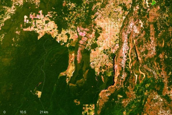
Researchers used satellite images from NASA’s Landsat archive to quantify land-use and land-cover (LULC) changes that occurred in Belize’s Orange Walk District in 1984-1987, 1999-2001 and 2014-2016. (Photo Credit: Nasa's Landsat 8 archive)


