
Gusty springtime winds turned the skies yellow and beige in mid-March 2021 across northern Mexico, New Mexico, and west Texas.
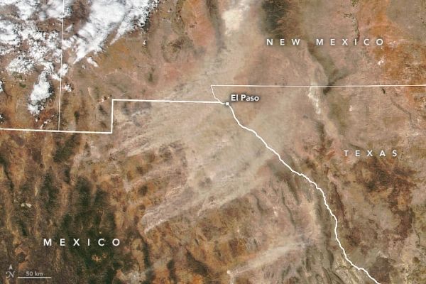
Gusty springtime winds turned the skies yellow and beige in mid-March 2021 across northern Mexico, New Mexico, and west Texas. A strong low-pressure system blowing along the Mexico-United States border scattered dust in an unusually long-lasting storm.
Sustained winds of 35 to 45 miles (55 to 70 kilometers) per hour —with gusts to 65 (100)—lofted abundant streams of dust from the Chihuahuan Desert. The storm lasted nearly eight hours, reduced visibility to below a half-mile in some places, and degraded air quality, particularly in the El Paso-Juárez metropolitan area.
The Visible Infrared Imaging Radiometer Suite (VIIRS) on the NOAA-NASA Suomi NPP satellite acquired a natural-color image (above) of the dust storm in the early afternoon on March 16, 2021. The NOAA-16 geostationary weather satellite acquired time-lapse video of the storm, including an enhanced product focused on the dust.
Read more at: NASA Earth Observatory
Using VIIRS data from NASA EOSDIS LANCE, GIBS/Worldview, and the Suomi National Polar-orbiting Partnership. (Photo Credit: NASA Earth Observatory image by Joshua Stevens)


