
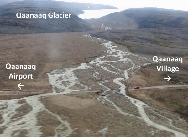
The river flowing from the Qaanaaq Glacier in northwest Greenland flooded in 2015 and 2016, washing out the only road connecting the small village of Qaanaaq and its 600 residents to the local airport.
The river flowing from the Qaanaaq Glacier in northwest Greenland flooded in 2015 and 2016, washing out the only road connecting the small village of Qaanaaq and its 600 residents to the local airport. What caused the floods was unclear at the time. Now, by combining physical field measurements and meteorological data into a numerical model, researchers at Japan’s Hokkaido University have some answers. They published their findings in the Journal of Glaciology.
In 2015, a combination of warm temperatures and strong winds led to a rapid increase in the Qaanaaq Glacier melting. In 2016, the culprit was different: torrential rainfall, which seldom occurs in the region, was the primary driver of the flooding. Both flooding events happened in August, at the end of the summer when most of the snow covering the glacier had melted, leaving the glacier’s ice exposed.
“There was nothing to absorb either melting ice water or rainfall, so it all flowed directly into the river,” explains Professor Shin Sugiyama, a glacier researcher at Hokkaido University’s Institute of Low Temperature Science.
Read More: Hokkaido University
An outlet stream from Qaanaaq Glacier flooded in August 2016, destroying the road to the airport (Photo Credit: Ken Kondo, et al. Journal of Glaciology. February 17, 2021)


