
One of the most comprehensive pictures of our changing planet is now available to the public.
Thanks to the close collaboration between Google Earth, ESA, the European Commission, NASA and the US Geological Survey, 24 million satellite photos from the past 37 years have been embedded into a new layer of Google Earth – creating a new, explorable view of time on our planet.
In the biggest update to Google Earth since 2017, users can now discover our planet in an entirely new dimension – time. With a new feature called Timelapse in Google Earth, users can witness nearly four decades of change across the entire planet. The update will show the visual evidence of the drastic changes taking place in our world including the effects of climate change and human behaviour.
Users can now take a journey across the world, exploring the ever-changing shapes of coastlines, follow the growth of megacities, track deforestation and much more. For each topic, Google Earth will take you on a guided tour to better understand the planet’s changes and how people experience them.
Continue reading at European Space Agency
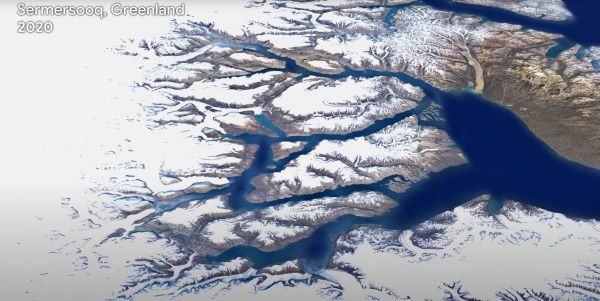
Image via European Space Agency


