
The glaciers of Nanga Parbat – one of the highest mountains in the world – have been shrinking slightly but continually since the 1930s.
The glaciers of Nanga Parbat – one of the highest mountains in the world – have been shrinking slightly but continually since the 1930s. This loss in surface area is evidenced by a long-term study conducted by researchers from the South Asia Institute of Heidelberg University. The geographers combined historical photographs, surveys, and topographical maps with current data, which allowed them to show glacial changes for this massif in the north-western Himalaya as far back as the mid-1800s.
Detailed long-term glacier studies that extend the observation period to the time before the ubiquitous availability of satellite data are barely possible in the Himalayan region due to the dearth of historical data. As Prof. Dr Marcus Nüsser from the South Asia Institute explains, this is not the case for the Nanga Parbat Massif. The earliest documents include sketch maps and drawings made during a research expedition in 1856. Based on this historical data, the Heidelberg researchers reconstructed the glacier changes along the South Face of Nanga Parbat. Additionally, there are numerous photographs and topographical maps stemming from climbing and scientific expeditions since 1934. Some of these historical photographs were retaken in the 1990s and 2010s from identical vantage points for the purpose of comparison. Satellite images dating back to the 1960s completed the data base Prof. Nüsser and his team used to create a multi-media temporal analysis and quantify glacier changes.
The Nanga Parbat glaciers largely fed by ice and snow avalanches show significantly lower retreat rates than other Himalayan regions. One exception is the mainly snow-fed Rupal Glacier, whose retreat rate is significantly higher. “Overall, more studies are needed to better understand the special influence of avalanche activity on glacier dynamics in this extreme high mountain region,” states Prof. Nüsser.
Read more at University of Heidelberg
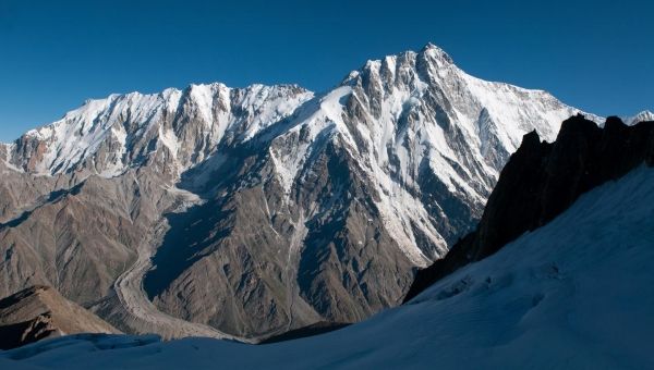
Image: Nanga Parbat: Photo of the Rupal flank taken in 2010 (Credit: Marcus Nüsser)


