
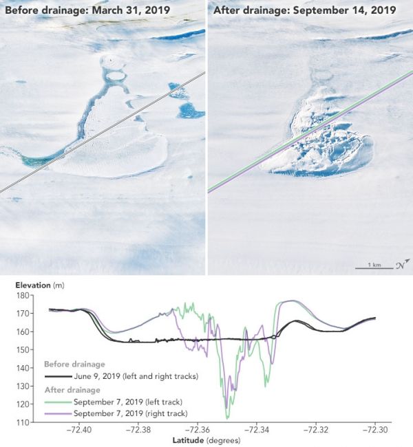
Satellites can “see” Antarctica’s surface deform as basins fill and empty on, within, and under the ice.
Despite the enormous weight and thickness of Antarctica’s ice, the surfaces of ice sheets and shelves can rise, deform, or fall in matters of days to weeks. One of the causes of this flexing is the periodic filling and draining of meltwater lakes on top of, within, and beneath the ice. In several new studies, scientists have used NASA’s Ice, Cloud, and land Elevation Satellite 2 (ICESat-2) to improve our view of this icy plumbing system.
At its thickest points, Antarctic ice can be hundreds to thousands of meters thick; the rising and falling caused by meltwater lakes tends to be subtle and localized. But with ICESat-2, scientists can map even small ice elevation changes with a precision down to just a few centimeters.
“These are processes going on under Antarctica that we wouldn’t have a clue about if we didn’t have satellite data,” said Helen Amanda Fricker, a glaciologist at Scripps Institution of Oceanography. “We’ve been struggling with getting good predictions about the future of Antarctica, and instruments like ICESat-2 are helping us observe at the process scale.”
Continue reading at NASA Earth Observatory
Image via NASA Earth Observatory


