
Equatorial Asia, which includes Indonesia, Malaysia, Papua New Guinea, and surrounding areas, experienced devastating biomass burning in 2015 due to the severe drought condition induced by the extreme El Niño and a positive anomaly of the Indian Ocean dipole. This biomass burning emitted a significant amount of carbon, mainly in the form of carbon dioxide (CO2), into the atmosphere.
Equatorial Asia, which includes Indonesia, Malaysia, Papua New Guinea, and surrounding areas, experienced devastating biomass burning in 2015 due to the severe drought condition induced by the extreme El Niño and a positive anomaly of the Indian Ocean dipole. This biomass burning emitted a significant amount of carbon, mainly in the form of carbon dioxide (CO2), into the atmosphere.
Equatorial Asia has very few ground-based stations that observe CO2 and other related atmospheric constitutents. Meanwhile, a few satellites could observe atmospheric CO2; however, their observations were less available and subject to errors due to cumulus cloulds typical in the tropics and smokes from the biomass burning.
To estimate the fire-induced carbon emissions from Equatorial Asia for 2015, the research team of the National Institute for Envrionmental Studies (NIES), Japan, and Meteorological Research Institute (MRI), Japan, expoloited high-precision observations onboard commercial passenger aircraft and a cargo ship that traveled in Equatorial Asia. These observations are unique because measurements are made on a moving platform, enabling to capture three-dimensional gradients of atmospheric CO2 concentrations. The aircraft observations are conducted by the NIES-MRI collaborative research project named CONTRAIL (http://www.cger.nies.go.jp/contrail/). The shipboard observations are operated by NIES as a part of the Global Environmental Monitoring project (https://db.cger.nies.go.jp/gem/en/warm/index.html).
Read more at National Institute for Environmental Studies
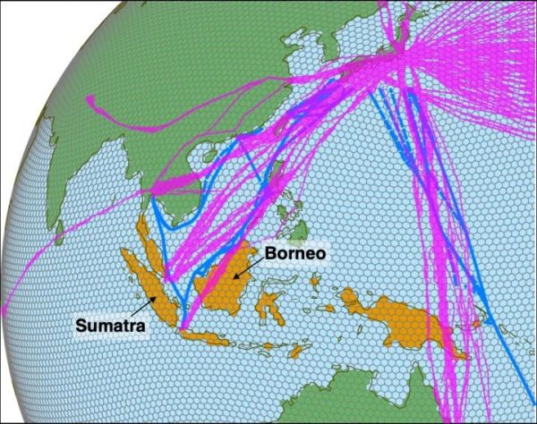
Image: Locations of the observations obtained by aircraft (magenta) and ship (blue) for Nov 2014 - Jan 2016. The orange region indicates Equatorial Asia, the target region of this study. (Credit: NIES)


