
Low water levels are due to recent trends in precipitation and long-term trends in consumption by humans.
In late July 2021, the Great Salt Lake in Utah reached its lowest water level on record, and it has continued dropping since then. On July 23, the U.S. Geological Survey (USGS) gauge at the Saltair boat harbor at the southern end of the lake recorded the average daily level at 4191.3 feet (1277.5 meters) above sea level, the lowest mark since measurements began in 1875. The previous low was set in 1963.
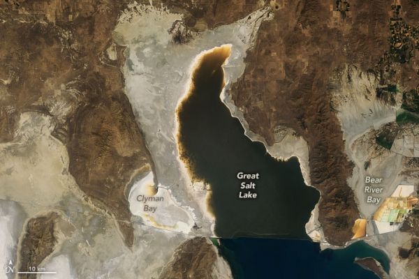
The Operational Land Imager (OLI) on Landsat 8 acquired images (above) of the north end of the Great Salt Lake on July 29, 2017, and July 24, 2021. Orange-brown areas along the edges of the lake indicate shallow water, while bright tan and white fringes suggest newly exposed portions of the lakebed. Note, too, the depletion of water in Clyman Bay and Bear River Bay. (Landsat also acquired images of the southern end of the lake during a similar dry spell in 2016.)
According to USGS, water levels in the southern part of the lake are usually a bit higher than the northern half because more tributaries flow into the southern section. The lake is divided by a causeway for the Union Pacific Railroad.
Continue reading at NASA Earth Observatory
Image via NASA Earth Observatory


