
River networks are among Earth’s most threatened hotspots of biodiversity and are essential for human wellbeing.
River networks are among Earth’s most threatened hotspots of biodiversity and are essential for human wellbeing. Climate change and increasing human water use are causing more rivers and streams to dry, but these drying river networks have received little attention. DRYvER is a Horizon 2020 project which will collect, analyse and model data from drying river networks across two continents—Europe and South America—to create a novel global meta-system approach that incorporates hydrology, socioeconomics, ecology and biogeochemistry in order to craft strategies, tools, guidelines, and recommendations for adaptive management of river networks.
Citizens can play a major role in helping scientists to understand drying river networks, by reporting drying events in rivers and streams. To do so, DRYvER has created the DRYRivERS app, which citizens can use to map drying events. The collected data will improve scientific predictions of the future impacts of climate change in these ecosystems. Moreover, DRYRivERS will raise awareness of the importance of drying events in river networks.
Read more at INRAE - National Research Institute for Agriculture, Food and Environment
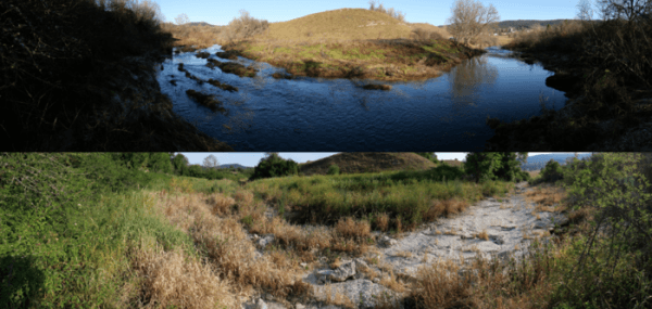
Image: Intermittent Albarine river in France (Credit: INRAE - B.Launay)


