
Soils across western Washington and southern British Columbia were saturated for much of the season.
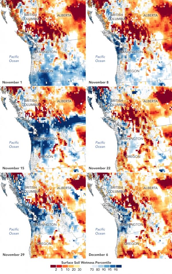
As meteorological autumn came to an end in 2021, parts of western Washington and southern British Columbia were still saturated from the barrage of rainstorms that repeatedly soaked the area. The moisture is especially evident in the region’s soils, which had little time to dry between storms.
These maps show a weekly “snapshot” of surface soil moisture from November 1 to December 6, 2021, as measured by the Gravity Recovery and Climate Experiment Follow-On (GRACE-FO) satellites. The colors depict the wetness percentile; that is, how the soil moisture on those days compared to long-term records (1948-2012). Blue areas have more abundant water than usual, and orange and red areas have less.
These maps represent the moisture in the top 2 centimeters (0.8 inches) of soil. Moisture in this layer—and slightly deeper in the root zone—can fluctuate significantly over short periods of time. Unlike deep groundwater aquifers, surface layer soils are quickly replenished by rainfall. Notice the vast expanse of wetter-than-usual (dark blue) soils on November 15, the third day of a potent storm. The narrow bands of moisture missed some locations, especially inland areas, where surface soils stayed drier than usual (orange and red) throughout the month.
Continue reading at NASA Earth Observatory
Image via NASA Earth Observatory


