
This coupling of the atmosphere and ocean alters atmospheric circulation and jet streams in ways that intensify rainfall in some regions and bring drought to others.
For the second year in a row, the cooler sister to El Niño showed up at the winter party in the Eastern Pacific. La Niña is expected to stick around until at least spring 2022 in the Northern Hemisphere.
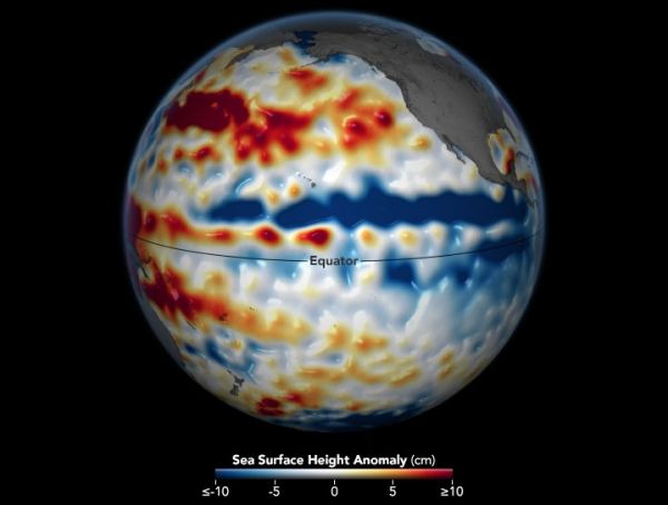
Part of the El Niño-Southern Oscillation cycle, La Niña appears when energized easterly trade winds intensify the upwelling of cooler water from the depths of the eastern tropical Pacific, causing a large-scale cooling of the eastern and central Pacific ocean surface near the Equator. These stronger than usual trade winds also push the warm equatorial surface waters westward toward Asia and Australia. This dramatic cooling of the ocean’s surface layers then affects the atmosphere by modifying the moisture content across the Pacific. This La Niña coupling of the atmosphere and ocean alters global atmospheric circulation and can cause shifts in the path of mid-latitude jet streams in ways that intensify rainfall in some regions and bring drought to others.
In the western Pacific, rainfall can increase dramatically over Indonesia and Australia during La Niña. Clouds and rainfall become more sporadic over the central and eastern Pacific Ocean, which can lead to dry conditions in Brazil, Argentina, and other parts of South America and wetter conditions over Central America. In North America, cooler and stormier conditions often set in across the Pacific Northwest, while weather typically becomes warmer and drier across the southern United States and northern Mexico.
Continue reading at NASA Earth Observatory
Image via NASA Earth Observatory


