
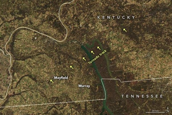
Preliminary reports suggest one tornado may have traveled nearly 200 miles, causing severe damage and human losses in Kentucky and three other states.
On the night of December 10, 2021, a potent storm front brought tornadoes, intense thunderstorms, and bursts of straight-line wind to the Midwestern United States. Though tornadoes can occur in any time of year—with roughly a dozen every December—the event was rare for how long it lasted and how far north it occurred in meteorological winter.
With unseasonably warm and humid weather in place in the mid-section of the U.S. and a cool weather front approaching from the west, the National Weather Service (NWS) predicted early on December 10 that severe weather was imminent: “A few strong tornadoes, damaging gusts, and large hail are all expected beginning this evening across Arkansas and Missouri, with the greatest tornado threat close to the confluence of the Mississippi and Ohio Rivers.”
A few hours later, as many as 70 tornado-like events were reported across the Midwest, killing at least 100 people and injuring hundreds more in Arkansas, Kentucky, Illinois, and Missouri. Preliminary reports suggest it was the deadliest tornado event in the U.S. since a tornado hit Joplin, Missouri, in 2011.
Continue reading at NASA Earth Observatory
Image via NASA Earth Observatory


