
A study conducted by scientists at the U.S. Geological Survey, the National Oceanic and Atmospheric Administration, and Vaisala Inc., published yesterday in the Geological Society of America’s journal Geology, discusses how advances in global lightning detection have provided novel ways to characterize explosive volcanism.
A study conducted by scientists at the U.S. Geological Survey, the National Oceanic and Atmospheric Administration, and Vaisala Inc., published yesterday in the Geological Society of America’s journal Geology, discusses how advances in global lightning detection have provided novel ways to characterize explosive volcanism. Lead author Alexa Van Eaton says, “It’s the perfect storm—explosive eruptions can create lightning that is detected around the world.”
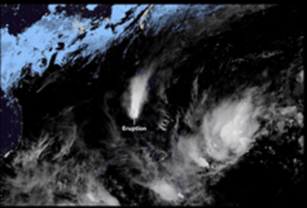
The January 2020 eruption of Taal volcano in the Philippines showed how a powerful volcanic eruption becomes electrified, giving off thousands of cloud-to-ground lightning strikes over several hours. Those flashes allow scientists to shed light on the eruption’s behavior. “As soon as the volcanic ash plume rose high enough to freeze, its electrical activity lit up our sensors,” says Van Eaton.
Radio waves produced by lightning travel at the speed of light, so, unlike other remote sensing tools with longer lag times, “we can receive the lightning data super-fast,” explains Van Eaton. The scientists also used satellite images and hundreds of photos shared on social media. “The eruption took place in a major urban area, so people posted pictures of volcanic lightning as it was happening.” Those photos and videos, Van Eaton and colleagues write, “reveal a highly electrified region at the base of the umbrella cloud.”
Read more at Geological Society of America
Image: In January 2020, the Taal volcano in the Philippines emitted hazardous amounts of volcanic ash and gases. The time-series animation shows the growth and spread of the volcanic plume from 12–13 January 2020, as observed by Japan’s Himawari-8 satellite. NASA Earth Observatory image by Lauren Dauphin, using OMPS data from the Goddard Earth Sciences Data and Information Services Center (GES DISC). Natural-color animation based on Himawari imagery, courtesy of the Japan Meteorological Agency. (Creit: Japan Meteorological Agency)


