
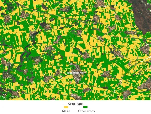
An instrument designed to measure tree height can also distinguish corn from other crops.
Every second, lasers mounted on the International Space Station send 242 rapid pulses of light down to Earth. These harmless beams from NASA’s Global Ecosystem Dynamics Investigation (GEDI) instrument bounce off Earth’s natural and human-made surfaces and are reflected back to the instrument. By measuring the time it takes for the signals to come back, scientists can derive the height of the surface below.
Scientists use these light detection and ranging, or lidar, measurements to create three-dimensional profiles of Earth’s surface. GEDI’s primary mission is to measure tree heights and forest structure in order to estimate the amount of carbon stored in forests and mangroves. New research supported by NASA Harvest reveals these data also can be used to map where different types of crops are being grown.
When David Lobell, an agricultural ecologist at Stanford University, saw researchers using GEDI data to estimate tree heights, he wondered how he could use the data to study agriculture. Stefania Di Tommaso and Sherrie Wang, researchers on his team, came up with the idea of using the data to distinguish different types of crops growing on farms.
Continue reading at NASA Earth Observatory
Image via NASA Earth Observatory


