
A first-of-its-kind study led by our Department of Geography has investigated the formation of surface meltwater lakes around the world’s largest ice sheet, offering new insights into the potential impact of recent climate change on the ‘Frozen Continent’.
A first-of-its-kind study led by our Department of Geography has investigated the formation of surface meltwater lakes around the world’s largest ice sheet, offering new insights into the potential impact of recent climate change on the ‘Frozen Continent’.
Mapping meltwater from space
The East Antarctic Ice Sheet is the world’s largest ice mass and holds enough ice to raise global sea levels by around 52 meters.
This study, which has been published in the journal Nature Communications, used over 2000 satellite images from a seven-year period (2014-2020) to study the size and volume of meltwater lakes forming on top of the ice sheet, also known as supraglacial lakes.
This is the first time that a year-on-year comparison of these lakes has been undertaken, providing experts with the opportunity to understand how the size and volume of the lakes varies annually, and how climate influences these changes.
Read more at: Durham University
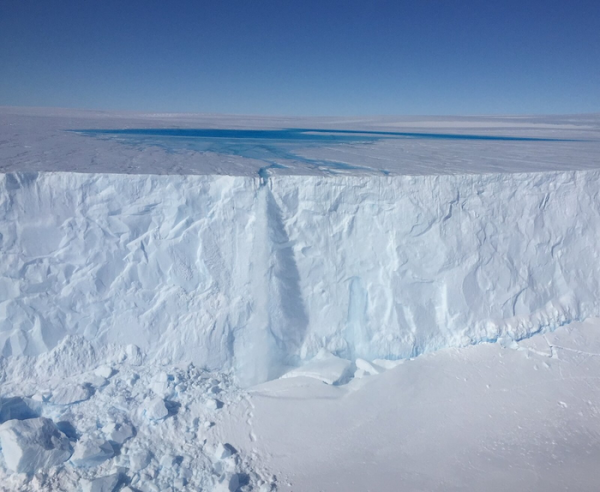
Meltwater lake on the Sørsdal Glacier. (Photo Credit: Dave Lomas)


