
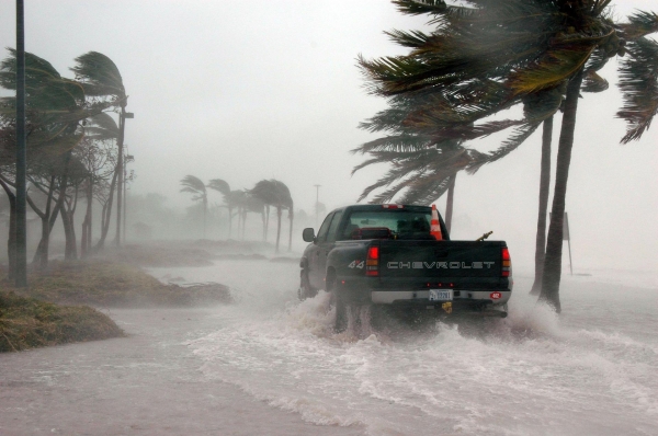
Extreme storms, like Sandy or Xaver, don’t happen often but when they do, cities need to be prepared.
Extreme storms, like Sandy or Xaver, don’t happen often but when they do, cities need to be prepared.
That’s why researchers have developed a new method, detailed in a study published this week in Nature, to determine where extreme events, like 100-year storm floods, are more likely to occur, whether the likelihood of such extremes is changing over time and why.
This is important information cities can use to help put flood-protection resources, such as larger sea walls or larger pump stations, where they are needed most.
“We don’t want to over design and waste money to build things bigger than they need to be, which is very expensive,” says Thomas Wahl, study co-author and an assistant professor in UCF’s Department of Civil, Environmental and Construction Engineering, and member of UCF’s National Center for Integrated Coastal Research.
“On the other hand, we don’t want to build things too small to just find out 20 years down the road that we underestimated the design and now we need to pay more money to further adapt our infrastructure,” he says.
The new study analyzes trends in storm surges over the past nearly 60 years and shows that, in addition to sea level rise, changes in storm surges are affecting the magnitude of extreme flooding events along the coasts of Europe.
However, while some places see an additional increase in extreme flooding events because of changes in the storm surges, others see a decrease.
Read more at: University of Central Florida
A slow-down in summer warming and ice loss in Greenland over the past decade is linked to a shift in El Niño to events over central Pacific, via an atmospheric remote forcing. (Photo Credit: Shinji Matsumura).


