
The drop in water levels comes as hotter temperatures and falling water levels left a smaller amount of water flowing through the Colorado River.
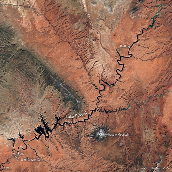
After decades of drought, water levels in Lake Powell, the second-largest humanmade reservoir in the United States, have shrunk to its lowest level since it was created more than 50 years ago, threatening millions of people who rely on its water supply. Satellite images allow us to take a closer look at the dwindling water levels of the lake amidst the climate crisis.
Straddling the border of southeast Utah and northeast Arizona, Lake Powell is an important reservoir in the Colorado River Basin. The Colorado River, which Lake Powell flows through, was dammed at Glen Canyon in the early 1960s. The lake provides water to approximately 40 million people, irrigates over 2.2 million hectares of land and has the capacity to generate more than 4200 megawatts of hydropower electricity.
In mid-March 2022, Lake Powell’s elevation dropped to an astonishing 1074 m above sea level – the lowest the lake has been since it was filled in 1980. This drastic drop in water levels is documented in natural-colour images captured by the Copernicus Sentinel-2 mission.
Continue reading at European Space Agency
Image via European Space Agency


