
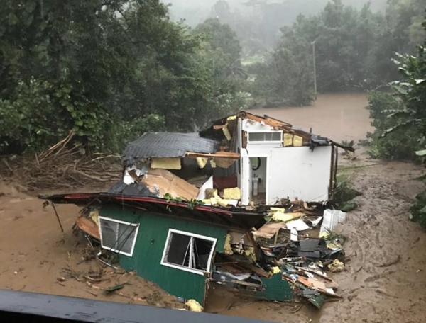
A record-setting rainstorm over Kaua‘i, Hawai‘i in April 2018 resulted in severe flash flooding and estimated damage of nearly $180 million.
The deluge damaged or destroyed 532 homes, and landslides left people along Kaua‘i’s north coast without access to their homes. In a recently published study, atmospheric scientists at the University of Hawai‘i at Mānoa revealed that severe supercell thunderstorms were to blame.
The rainstorm inundated some areas with nearly 50 inches of rainfall in a 24-hour period, smashing the previous 24-hour U.S. rainfall record of 42 inches set in Texas in 1979. An interesting finding is that the rainstorm described in this paper was associated with a kona low and not a tropical cyclone as featured in previous U.S. rainfall records.
Terrence Corrigan, a doctoral candidate, and professor Steven Businger, both in the Department of Atmospheric Sciences at the UH Mānoa School of Ocean and Earth Science and Technology, sifted through copious weather radar data from NOAA’s National Weather Service to unveil the factors contributing to this historic event. Their analysis revealed large changes in the direction and speed of the winds in the lower atmosphere. When these shifting winds collided with Kaua‘i steep cliffs, thunderstorms with rotating updrafts were triggered. The scale of rotation seen in radar data, and the strength of rainfall seen as reflectivity echos are consistent with supercell thunderstorms.
Continue reading at University of Hawai‘i at Mānoa
Image via University of Hawai‘i at Mānoa


