
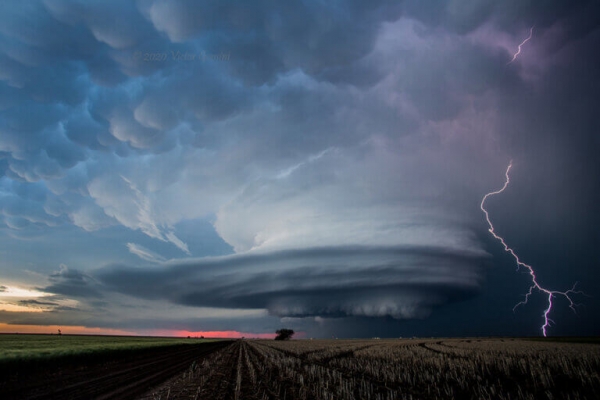
Scientists at Northern Illinois University continue to hone extended-range weather forecasting, identifying patterns halfway around the globe that will heighten the probability weeks later for hail- and tornado-producing storms in the United States.
Scientists at Northern Illinois University continue to hone extended-range weather forecasting, identifying patterns halfway around the globe that will heighten the probability weeks later for hail- and tornado-producing storms in the United States.
New research identifies three specific orientations of atmospheric phenomena occurring near the equator over the Maritime continent that increase the probability of severe U.S. weather events three to four weeks later. Using such information to create extended-range forecasts would provide more time to raise awareness of severe weather, and potentially save lives and property.
Combing through data from 1979–2019, the scientists found 100 instances of significant fluctuations that had occurred in the Madden-Julian Oscillation (MJO)—a major eastward moving disturbance of winds, rain and pressure—and looked for correlations to U.S. severe weather weeks later.
As an MJO moves eastward along the equator, it can weaken or strengthen as it crosses the islands of the Maritime Continent, which include Indonesia and the Philippines. Of the 100 identified MJO fluctuations, 53 of these storm clusters gained strength as they crossed the Maritime Continent and entered the Pacific Ocean, causing ripples in the atmosphere and eventually changing circulation patterns over North America.
Read more at Northern Illinois University
Image Credit: Victor Gensini, Northern Illinois University


