
Air quality planning agencies in the U.S. Great Lakes region now include high-resolution NASA satellite data and near real-time Earth observations in their ozone pollution assessments.
Creating models that accurately predict the complex lake and land breezes along Lake Michigan's shoreline is very difficult, but it’s also vital to understanding how ozone pollution circulates in the region.
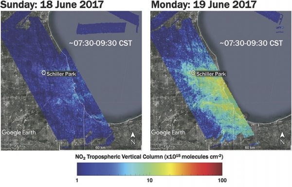
The unique weather of the Lake Michigan shoreline can create pockets of high levels of ground-level ozone. This air pollutant is created by emissions from cars, trucks, fossil-fuel power plants, and other sources. It is also monitored by local and federal regulators, which require states to “attain,” or meet, federal air quality standards.
“Our member states are facing several non-attainment areas in this region that are violating federal ozone standards,” said Zac Adelman, the head of the Lake Michigan Air Directors Consortium (LADCO). “This system is operational and we’re using it from a policy standpoint now – we’re actively deploying the modeling systems developed through this project to simulate mitigation efforts and inform the states’ attainment strategies.”
To make sure the right data was getting into the right hands and in the right format, this NASA-funded project worked with LADCO and the Wisconsin Department of Natural Resources (WDNR) to create a modeling tool that incorporates satellite data into ozone monitoring efforts. Adelman said this is important to improve confidence in policy decisions for lowering ozone pollution. Data comes from sources such as NASA and the National Oceanic and Atmospheric Administration (NOAA).
Continue reading at NASA
Image via NASA


