
Earth Observation (EO) experts based at the University of Leicester have laid bare the UK’s record-breaking heatwave with data captured from space.
Earth Observation (EO) experts based at the University of Leicester have laid bare the UK’s record-breaking heatwave with data captured from space.
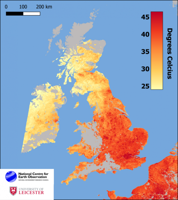
Leicester scientists affiliated to the National Centre for Earth Observation (NCEO), headquartered at Space Park Leicester, have mapped measures of land surface temperature – topping out at 52°C – as measured by the pair of Sentinel-3 satellites in orbit more than 800km (500 miles) above Earth.
Their map shows the temperature of the Earth’s surface at approximately 10.20am on Monday morning as seen by the satellites’ Sea and Land Surface Temperature Radiometer (SLSTR). The satellites are operated by the European Space Agency (ESA).
Land surface temperature is a separate measure to ambient air temperature, but the two are fundamentally linked. The warmth rising off Earth’s landscapes influences (and is influenced by) our world’s weather and climate patterns.
Read more at University of Leicester
Image: Map showing measured land surface temperature of the UK, detected at approximately 10.20am on Monday 18 July 2022 by Sentinel-3 (ESA). Credit: NCEO/University of Leicester (Credit: NCEO/University of Leicester)


