
Scientists and regulators are using satellite data and custom models from NASA to help monitor ozone pollution.
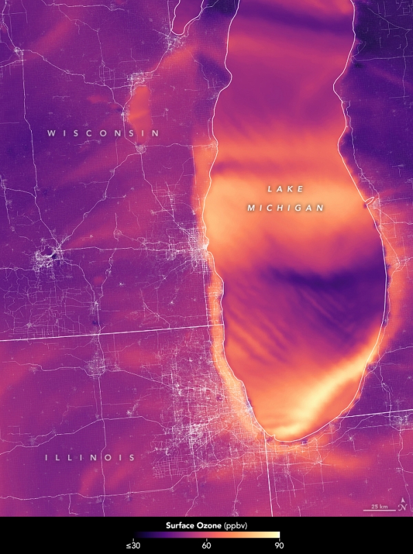
The complex lake and land breezes and the atmospheric pressure differences across the Great Lakes region of North America can result in high levels of ozone pollution that are difficult to monitor or predict. Recently, air quality experts began incorporating more satellite data and customized models from NASA to better track that pollution. Their goal is to better inform local decision-making about how to improve air quality.
Federal air quality standards aim to protect the public from unhealthy levels of ground-level ozone, among other pollutants. Those most at risk include children (as their lungs are still developing); elderly populations; individuals with existing lung conditions; and people who are active outdoors. When air pollution levels exceed the standards set by the Environmental Protection Agency (EPA), they can aggravate lung diseases such as emphysema and chronic bronchitis, while increasing the frequency of asthma attacks.
Recently the Lake Michigan Air Directors Consortium (LADCO) and the Wisconsin Department of Natural Resources teamed with NASA researchers to improve the accuracy and spatial resolution of air quality assessments for Illinois, Indiana, Michigan, Minnesota, Ohio, and Wisconsin. Their goal was to integrate more datasets while developing finer-scale models for how ozone circulates in the region.
Continue reading at NASA Earth Observatory
Image via NASA Earth Observatory


