
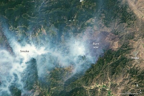
More than a week after it ignited, the McKinney Fire continued to burn through the Klamath National Forest in Northern California.
More than a week after it ignited, the McKinney Fire continued to burn through the Klamath National Forest in Northern California. It was the state’s largest and deadliest wildland fire so far in 2022.
The scarred landscape and smoke from actively burning fires are visible in the images above. The images were acquired on August 6, 2022, by the Operational Land Imager (OLI) on Landsat 8.
The false-color image (right) was composed from shortwave infrared, near-infrared, and green light. This band combination (6-5-3) cuts through the smoke to reveal burn scars (brown). From ignition on July 29 through the time of this image, the McKinney Fire burned more than 60,000 acres (243 square kilometers) of timber, brush, and grass. It was 40 percent contained by midday on August 8.
Notice the smaller burn scar to the west. This land was burned by Yeti Complex fires (Yeti and Alex), which were ignited by lightning in the Klamath National Forest on the same day as the McKinney Fire. By August 6, the Yeti Complex had burned more than 7,000 acres (28 square kilometers) and was not contained on any side.
Read more at: NASA Earth Observatory
Photo Credit: NASA Earth Observatory


