
A low, surging wind picks up as the first few raindrops splatter onto dusty ground. Dense cumulonimbus clouds, like soot-stained cotton balls, knot tighter and tighter in the sky.
A low, surging wind picks up as the first few raindrops splatter onto dusty ground. Dense cumulonimbus clouds, like soot-stained cotton balls, knot tighter and tighter in the sky. While the thick scent of petrichor and ozone invades the air, an electric burst of lightning slashes through the sky; deafening cracks of thunder follow, like the footsteps of some celestial giant crashing through the atmosphere.
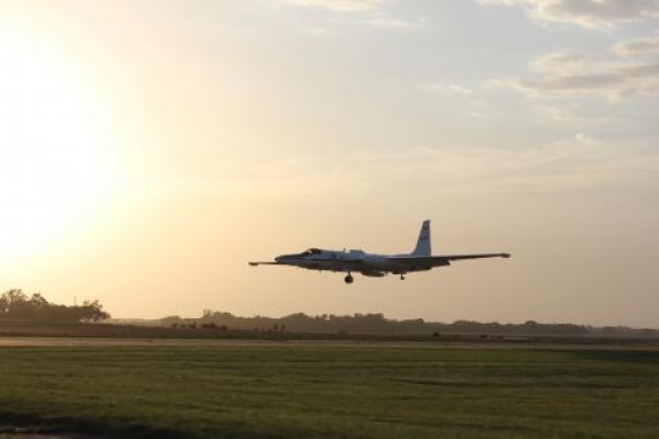
Summer thunderstorms like this may last just a few minutes, or for several hours. In their wake, the NASA Dynamics and Chemistry of the Summer Stratosphere, or DCOTSS, operations room buzzes with activity. After a storm, the Kansas-based crew sends out a high-altitude plane loaded with instruments to take measurements and make observations.
In a process called convection, thunderstorms’ roiling activity draws up warm air from the lower atmosphere and cools it as it travels higher, sometimes shooting it into the next atmospheric layer above called the stratosphere. The DCTOSS team aims to figure out exactly what material swirling in the air gets transferred between atmospheric layers when this happens.
“Until this mission, nobody had ever tried to do this,” said Ken Bowman, DCOTSS principal investigator. “There haven’t been direct observations to tell us how this happens or how important it is.” Bowman and his crew completed their final fight in July, and are now back at in the lab to begin sorting through the data they’ve collected.
Read more at NASA
Image: NASA’s ER-2 landing after a day spent flying above thunderstorms for the DCOTSS field campaign. Credit: NASA/Cameron Homeyer


