
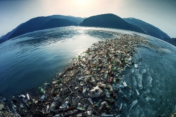
Every 60 seconds the equivalent of a lorry-load of plastic enters the global ocean.
Every 60 seconds the equivalent of a lorry-load of plastic enters the global ocean. Where does it end up? Right now, researchers simply don’t know. But in a bid to help find out, an ESA-led project developed floating transmitters whose passage can be tracked over time, helping in turn to guide a sophisticated software model of marine plastic litter accumulation.
In a hi-tech version of throwing out messages in bottles, prototype trackable buoys were deployed in the waters off Indonesia, whose myriad of islands results in some of the most complex, unpredictable currents on Earth.
Made from wood for maximum sustainability, the buoys were developed by French organisation CLS, Collecte Localization Satellites. A subsidiary of French space agency CNES, CLS is best known for overseeing the satellite-based tracking of tagged marine animals, buoys and fishing fleets using its long-running Argos geopositioning system, which performs satellite navigation fixes and returns them to CLS via satellite link.
CLS made use of previous experience of marine plastic litter in Indonesia for the buoy deployments. It has previously teamed up with the Indonesian Ministry of Marine Affairs and Fisheries to help guide waste collection efforts – the country’s national marine pollution plan pledges to reduce plastic waste by 70% by the end of 2025.
Continue reading at European Space Agency
Image via European Space Agency


