
After a tantalizing year-and-a-half wait since the Mars Perseverance Rover touched down on our nearest planetary neighbor, new data is arriving — and bringing with it a few surprises.
After a tantalizing year-and-a-half wait since the Mars Perseverance Rover touched down on our nearest planetary neighbor, new data is arriving — and bringing with it a few surprises.
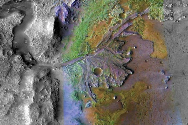
The rover, which is about the size of car and carries seven scientific instruments, has been probing Mars’ 30-mile-wide Jezero crater, once the site of a lake and an ideal spot to search for evidence of ancient life and information about the planet’s geological and climatic past.
In a paper published today in the journal Science Advances, a research team led by UCLA and the University of Oslo reveals that rock layers beneath the crater’s floor, observed by the rover’s ground-penetrating radar instrument, are unexpectedly inclined. The slopes, thicknesses and shapes of the inclined sections suggest they were either formed by slowly cooling lava or deposited as sediments in the former lake.
Read More at: University of California - Los Angeles
Aerial photo of the remains of a delta where a water source once fed an ancient lake at the Jezero crater. NASA’s Perseverance Rover is currently exploring the area. (Photo Credit: NASA/JPL-Caltech/ASU)


