
By 2050 – just 28 years from now – the sea level along the Long Island Sound shoreline is projected to be 18 inches above today’s levels.
By 2050 – just 28 years from now – the sea level along the Long Island Sound shoreline is projected to be 18 inches above today’s levels. By 2100 it could be as much as six and a half feet higher than current levels. Climate change-driven severe weather events, like intense hurricanes, are also projected to increase in frequency. What this all means for the densely populated coast, which includes some of the largest towns in the state, is that significant changes are on the way.
UConn Department of Plant Science and Landscape Architecture researcher Tao Wu ’21 Ph.D and Extension Educator with the Connecticut Sea Grant program Juliana Barrett recently published a study looking at land use changes from the past and the importance of taking factors such as socio-economic development and the dynamic nature of coastal environments into consideration to make these areas more resilient to climate change. Their findings are published in Environmental Management.
This research focused on Connecticut, with 96 miles of coastland and 24 towns along the Long Island Sound shoreline, and the ways previous coastal land use changes have impacted resilience.
Connecticut’s coastal areas are vulnerable after rapid development in the 19th and 20th centuries, and because much of the land is less than 20 feet above sea level, the researchers say.
Read more at University of Connecticut
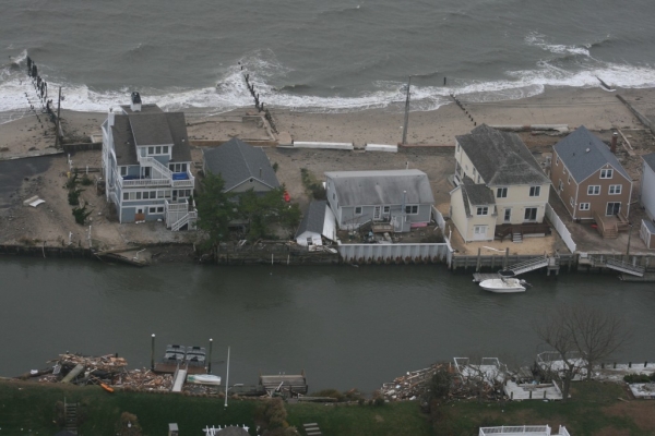
Image: Hurricane Sandy hit the Connecticut shoreline and Long Island Sound in October 2012, further exposing the state's vulnerable shoreline. Researchers say new approaches to resilience are needed as sea levels rise and powerful storms become more common (Photo courtesy of Connecticut National Guard)


