
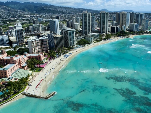
The Royal Hawaiian Beach in Waikīkī is a popular beach at the center of Hawai‘i’s tourism hub, with a valuation of $2.2 billion, according to a 2016 study.
The Royal Hawaiian Beach in Waikīkī is a popular beach at the center of Hawai‘i’s tourism hub, with a valuation of $2.2 billion, according to a 2016 study. Two recently published studies from researchers at the University of Hawai‘i (UH) at Mānoa’s Climate Resilience Collaborative (CRC) provide new understanding of how and why this iconic beach is chronically eroding—enabling coastal managers and policymakers to more effectively manage the coastline.
During a two-year study from 2018 to 2020 that included weekly surveys, a research team led by CRC geospatial analyst Anna Mikkelsen, found that the beach is primarily dominated by longshore transport, meaning that sand is moved from one end of the beach to another. This is contrary to standard beach models that predict cross-shore transport where sand is moved from nearshore to an offshore section of the beach.
“Another surprising finding was that we did not find any clear seasonal signal,” said Mikkelsen. “Instead of seeing high volumes of sand in summer, and low volumes in winter, we saw consistently increasing beach volume the first 12 months of the study and then erosion of the beach the following 10 months.”
The researchers discovered that the primary environmental drivers controlling the amount of sand present and the width of the beach include wave energy from south swell and trade-wind generated waves, and the water level.
Read more at University of Hawaii at Manoa
Image: Aerial image of Royal Hawaiian Beach. (Credit: UH Climate Resilience Collaborative)


