
Soil erosion is a significant problem for agricultural production, impacting soil quality and causing pollutants to enter waterways.
Soil erosion is a significant problem for agricultural production, impacting soil quality and causing pollutants to enter waterways. Among all stages of soil erosion, gully erosion is the most severe phase, where large channels are carved through the field. Once gullies develop, they are challenging to manage through tiling; they require a more comprehensive approach along the impacted area.
University of Illinois researchers developed a modeling framework that uses remote sensing environmental data to predict gully erosion susceptibility more accurately. This predictive model allows landowners and conservation agencies to direct management resources to the most vulnerable areas.
“Erosion processes are complicated to predict, because there are so many factors at play, including farmer activity, climate, rainfall, temperature, vegetation development, topography, and many other variables that are always changing over time. We wanted to incorporate more of these variabilities in space and time in our model to decrease the uncertainty of the prediction,” says Jorge Guzman, research assistant professor in the Department of Agricultural and Biological Engineering (ABE) at the U of I and co-author on the paper, published in the Journal of Hydrology: Regional Studies.
Read more at: University of Illinois College of Agricultural, Consumer and Environmental Science
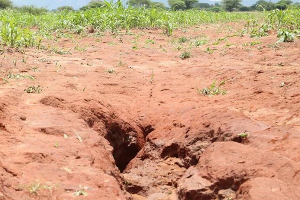
Gully erosion. (Photo Credit: IITA/Jonathan Odhong, flickr.com)


