
There is a wide range of methods to determine the level of a watercourse - from very simple ones (by yardstick or staff gauge) to advanced radar solutions.
There is a wide range of methods to determine the level of a watercourse - from very simple ones (by yardstick or staff gauge) to advanced radar solutions. But they all have a catch: Most measuring devices can be damaged due to direct exposure to the high water level, many do not allow continuous monitoring, remote reading is difficult or they are simply too expensive.
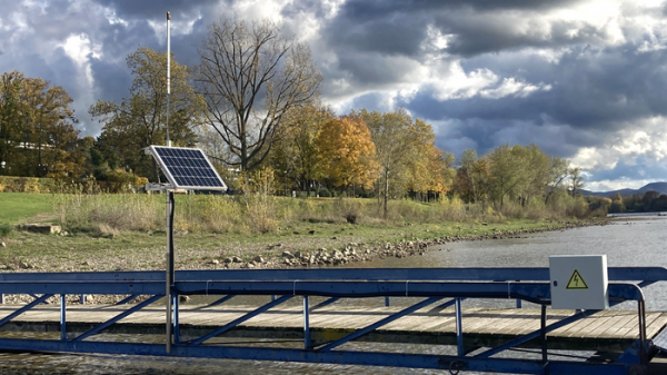
In Wesel on the Lower Rhine, however, a measuring device that does not have these disadvantages has already been in service for two years: It is cost-effective, reliable and capable of continuously transmitting the water level to an evaluation center via mobile communication. In principle, this means that such a sensor is suitable for providing a densely-distributed network for flood and drought warning systems.
"The core of our device is a low-cost GNSS receiver and antenna," explains Dr. Makan Karegar of the Institute of Geodesy and Geoinformation at the University of Bonn. This is a sensor that can conventionally determine the position of its location with several meter accuracy. It does this using the US GPS satellites and their Russian counterparts, GLONASS. "However, satellite signals can also be used to measure the height of the GNSS antenna above the river surface," Karegar says.
Read more at: University of Bonn
Can be operated with solar cells and then works completely stand alone with no maintenance. (Photo Credit: Makan Karegar/University of Bonn)


