
The upcoming Surface Water and Ocean Topography mission will provide a trove of data on Earth’s water resources, even in remote locations.
The upcoming Surface Water and Ocean Topography mission will provide a trove of data on Earth’s water resources, even in remote locations. Alaska serves as a case study.
While Alaska straddles the Arctic Circle and is covered by vast expanses of frozen land, the state also has a lot of liquid water. In fact, Alaska holds about 40% of U.S. surface water resources. This includes more than 12,000 rivers, thousands more streams and creeks, and hundreds of thousands of lakes.
So when the Surface Water and Ocean Topography (SWOT) satellite launches this month from California’s Vandenberg Space Force Base, it’s only natural that Alaska will be among the first beneficiaries of this mission led by NASA and the French space agency Centre National d’Études Spatiales (CNES), with contributions from the Canadian Space Agency and the UK Space Agency.
Read more at NASA
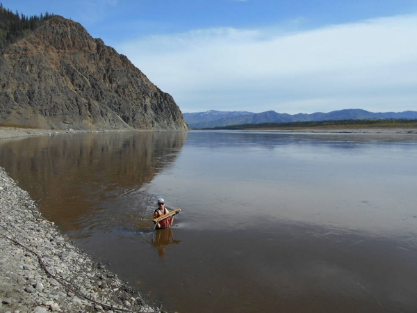
Image: USGS hydrologist Heather Best makes a wading stream measurement at a gauge monitoring station in Alaska. The state’s size, rugged terrain, and limited transportation infrastructure make traditional stream gauging cost prohibitive. (Credits: Derek Frohbieter, North Carolina Association of Floodplain Managers)


