
Meet the scientific heart of the Surface Water and Ocean Topography mission, which will see Earth’s water in higher definition than ever before.
Meet the scientific heart of the Surface Water and Ocean Topography mission, which will see Earth’s water in higher definition than ever before.
Set for a Thursday, Dec. 15 launch, the Surface Water and Ocean Topography (SWOT) satellite promises to provide an extraordinary accounting of water over much of Earth’s surface. Its measurements of fresh water and the ocean will help researchers address some of the most pressing climate questions of our time and help communities prepare for a warming world. Making this possible is a scientific instrument called the Ka-band Radar Interferometer (KaRIn).
Years in development, the instrument has been designed to capture very precise measurements of the height of water in Earth’s freshwater bodies and the ocean. KaRIn will measure the height of water in the ocean, “seeing” features like currents and eddies that are less than 13 miles (20 kilometers) across – up to 10 times smaller than those detectable with other sea level satellites. It will also collect data on lakes and reservoirs larger than 15 acres (62,500 square meters) and rivers wider than 330 feet (100 meters) across.
Read more at NASA
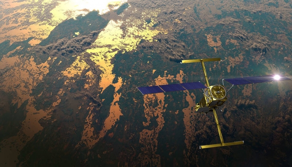
Image: This illustration shows the Surface Water and Ocean Topography (SWOT) satellite in orbit with sunlight glinting off one array of solar panels, as well as both KaRIn instrument antennas deployed. (Credits: CNES)


